 Camilla Jessen
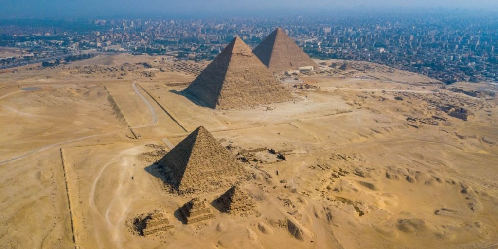
A newly discovered extinct branch of the Nile River might explain the strategic locations of Egypt’s pyramids and how they were built, according to recent research.
More than 30 pyramids in Egypt are located in an unremarkable strip of barren desert far from the modern Nile River. Now, scientists may have found the reason for this.
An extinct branch of the Nile River could explain the pyramids’ location and how they were built, according to recent research.
The Ancient Ahramat River
Researchers from the University of North Carolina Wilmington have discovered an ancient waterway, which sheds light on why so many pyramids are concentrated in this region. This finding also addresses the long-standing question of how the massive materials required to build the Giza complex and other pyramids were transported.
This area near the ancient Egyptian capital of Memphis includes the Great Pyramid of Giza—the only surviving wonder of the ancient world—as well as the Khafre, Cheops, and Mykerinos pyramids.
Today, the pyramid field is quite a distance from the Nile River. Archaeologists have long hypothesized that the ancient Egyptians must have used a nearby waterway to move the enormous materials needed for the pyramids.
In their recent study, researchers used satellite imagery to locate a potential former river branch running near the pyramid fields, close to the Western Desert Plateau’s foothills. After identifying a viable candidate, they collected sediment samples and conducted geophysical surveys in the region.
The researchers uncovered evidence of a 64-kilometer (40-mile) ancient branch of the Nile River that has since vanished. They propose naming this ancient river “Ahramat,” meaning “pyramids” in Arabic.
In a report published in the journal Communications Earth & Environment, the researchers stated: “Many of the pyramids, dating to the Old and Middle Kingdoms, have causeways that lead to the branch and terminate with Valley Temples which may have acted as river harbors along it in the past. We suggest that the Ahramat Branch played a role in the monuments’ construction and that it was simultaneously active and used as a transportation waterway for workmen and building materials to the pyramids’ sites.”
The Disappearance of the River
It appears the river branch was around 39 miles long and over 2,000 feet wide. However, after a severe drought, the area became covered in windblown sand and was gradually lost to the desert and farmland.
Field surveys and sediment cores confirmed the presence of this ancient river, according to the study in Communications Earth & Environment.
Unlike the arid and inhospitable landscape known today, up to 6,000 years ago, this valley was a network of freshwater marshes and floodplains. By the beginning of the Old Kingdom period (around 2686 B.C.E.), inhabitants had settled on the natural levees of the river and jeziras (islands).
The Ahramat Branch gradually shifted eastward, with abandoned channels still visible on historical maps from 1911. Dahshur Lake is likely the last remaining trace of this ancient tributary.
“As branches disappeared, ancient Egyptian cities and towns also silted up and disappeared, and we have no clue where to find them,” said Dr. Eman Ghoneim.